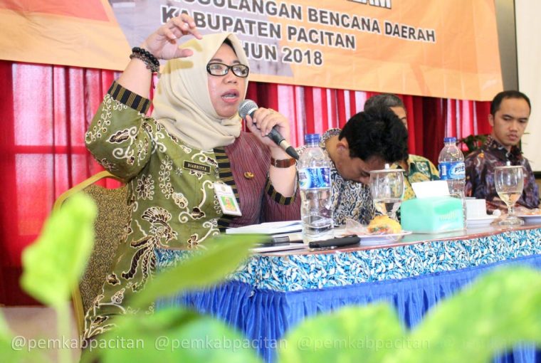
Staff of Universitas Gadjah Mada Disaster Study Center or Pusat Studi Bencana (PSBA), Guruh Samudra explained clearly about landslide potential as well the hardware and application to measure rainfall, before explained how to operate and read the red map on the application. “building harmony with landslides, first we need to know rainfall threshold. With the result that enhancement of local coping capacity” said Guruh at Socialization Monitoring and Dissemination of Public Information about disaster Potential BPBD Pacitan 09/11/18 at Hotel Srikandi hall.
According to him the outline of the discussion is educative interpreter which is the residents, from installed Hardware data connected to android application so that interpreted convenient color symbol. Then residents will understand the soil condition where they lived. Guruh declared that the application was expansion from Early Warning System that assessed way more effective. If the residents used to saw and learn about rainfall absolutely they will get used too to respond the threshold, as the result of that if landslides occur, residents will safe. “The Early Warning is not on the device but on its human” said Guruh.
Head of PSBA Dr. Djati Mardianto confirmed this, the purpose of this application is to educate residents. According to him, Pacitan as morphologically hills and mountain cause high prone landslides area. Furthermore, as tropic area, rain is one of the elements. Djati said “Should be aware by the fact that Pacitan was formed from old volcano materials and soluble limestone, concluded unstable. The equipment and application role was to informed also systematically it, as the responsible result.”
Total of 190 landslides point were recorded by BPBD, even Diannitta Agustinawati, section chief of Prevention and Preparedness of BPBD Pacitan said the amount can possibly change. As for that SiApps Village concept which already socialized together become clues for residents and policy holder to take an action.
Participants who join the socialization were all over village in four sub district, that is Pacitan, Kebonagung, Arjosari, and Pringkuku. Meanwhile, equipment and application demo located in Kedungbendo Village, Arjosari. “for the others village that already had landslides prone potential will develop similar initiative from the ministry, because the equipment as well the application are important in mitigation attempt to improve coping capacity in reducing the risk of landslide disasters” added him.
This socialization also delivered material about the establishment of Desa Tangguh Bencana (Destana) by Diana Rendraini as facilitator, and then Wira Swastika from Diskominfo who provided material about SID (Village System Information), Hamdani as Umbuls’s Village Officials, Best Practice within utilize Village System Information for analize disaster data as long as Pusat Data Dan Informasi Kebencanaan (Pusdatin) BPBD team, with expectation all the provided information able to give awareness for the rersidents to be more capable and well prepared facing impact that will occur in landslides prone area. (Budi/Anj/Riyanto/DiskominfoPacitan).
Source : https://pacitankab.go.id/desa-siapps-solusi-zona-rawan-longsor/
